
Geotab ITS Interactive Map
Discover how data insights from freight and commercial vehicles can be used to improve infrastructure efficiency, sustainability, profitability and safety.
Discover how data insights from freight and commercial vehicles can be used to improve infrastructure efficiency, sustainability, profitability and safety.

Geotab ITS customers and partners are invited to participate in this years Geotab Connect 2024 with a specialized ITS agenda.

Understanding how transportation planners can use vehicle vocation information for meaningful analysis.

New Stop Cluster feature allows for custom analysis into where vehicles are truly stopping without the constraints of pre-defined shapes or zones.
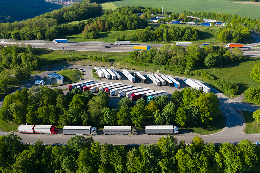
Geotab ITS today announced the launch of Stop Analytics, a powerful data analytics module that offers aggregate commercial vehicle parking insights.

Using Stop Analytics from Geotab ITS, planners can expedite priority parking infrastructure to keep pace with commercial vehicle needs and improve traffic…

At Geotab ITS, we saw firsthand the impact that deeper contextual transportation analytics can have for future modeling and infrastructure planning. Geotab…

New funding opportunities for UTCs highlight the need for insightful data analytics to move research forward and find innovative solutions to commercial…

In our latest eBook, understand commercial and last-mile delivery traffic in the new normal.

Find out how the rise of ecommerce has created a knock-on effect on the curbsides of many major cities.