What is traffic data collection and how does Geotab ITS gather and aggregate traffic analytics?

Traffic data collection is a gateway for countless powerful use cases. Geotab ITS provides anonymized and aggregated traffic insights to help organizations achieve their specific transportation goals.
Traffic data collection is becoming increasingly important, as both companies and agencies are progressively using vehicle movement insights to guide their objectives. It’s critical for these organizations to rely on traffic data that’s reliable, gathered from quality sources and stratifiable. In doing so, they can develop more prescriptive solutions to the transportation problems they’re trying to solve. This article will explain what traffic data collection is, how it’s used and Geotab ITS’ process around gathering and anonymizing our analytics.
What is traffic data collection?
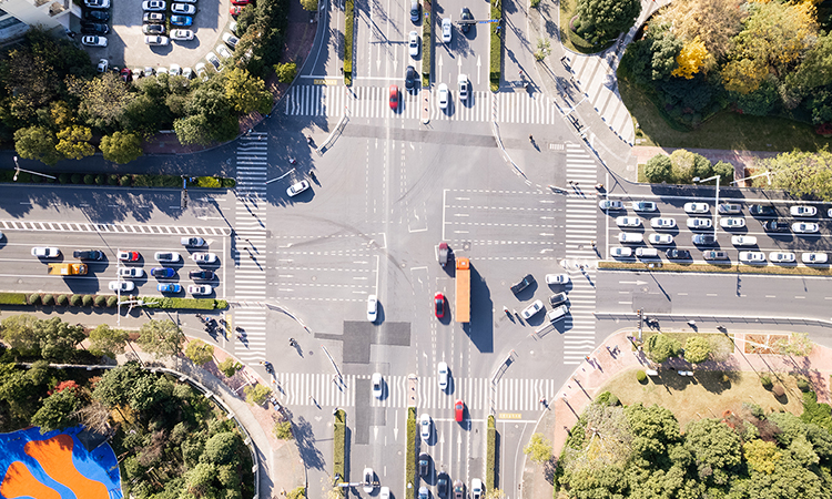
Traffic data collection is the practice of gathering, aggregating and presenting vehicle movement insights within a defined area. Depending on the curator of the insights, data may be extracted from vehicle hardware devices, ground truths reported by machines, manual counters or other key sources. Analytics from traffic data collection often report vehicle counts, but with contextual data, valuable insights about vehicle driving habits, classes, vocations and origins or destinations can additionally be found.
Organizations can sift through traffic data and segment it to meet their project’s needs. For businesses, they can look at categories like average annual daily traffic (AADT), origin and destination insights and vehicle vocations to select optimal sites for new real estate. State agencies and departments can study stoppage data, road analytics and Regional Travel Metrics (RTM) to identify unsafe or inefficient road networks and implement new solutions to improve them.
How is traffic data used in transportation planning?
Traffic data is used by transportation planners to validate assertions and measure the effects of enacted policies or new infrastructure they’ve built. Modelers and planners can compare differences in the data from before and after a new strategy has taken effect to see if it’s working as intended. Below are a few key examples of traffic data in action:
- Organizations can evaluate how safe or efficient a particular segment of road is by analyzing average travel times, bottlenecks and speeds along it.
- Departments of transportation can measure the traffic effects of an infrastructure crisis on surrounding roadways, should one occur.
- Governments can increase equity and fairness of mobility by identifying areas of improvement needed in the grid that are indicated by traffic data.
- Agencies can improve regional sustainability by using traffic data and Stop Analytics to choose high-potential new locations for electric vehicle chargers.
- States and regions can advance economic growth and smoothen supply chains by using data to uncover and prevent common traffic snarls.
Geotab ITS conducts traffic data collection to provide organizations with reliable and contextualized transportation insights. We follow strict strategies in our data collection and anonymization process, enabling us to provide unparalleled insights with effective security controls backing them up.
Geotab ITS’ approach to traffic data collection
Geotab ITS sources its data from over 4.3 million commercial vehicles, 26 million trips a day and over 190 million miles driven each day. Our data is gathered from a collection of Geotab telemetry hardware, original equipment manufacturer (OEM) and third-party solutions. It is only presented after it’s been anonymized and aggregated. Many of the types of data we factor in when providing our insights include:
- GPS locations
- Vehicle classes
- Driving behaviors
- Travel times and speeds
Our Expansion Factors also enable us to provide an accurate portrayal of all commercial vehicle movement within a region by making the data proportional to actual volumes and comparing the totals against outside reported ground truths. Throughout the entire traffic data collection process, Geotab ITS strongly emphasizes keeping our customers’ data anonymized and protected. Next, we’ll address how we safeguard our valued clients’ privacy each step of the way.
How Geotab ITS protects data and anonymizes information
Geotab ITS strongly believes in protecting our customers’ data and we follow a number of stringent protocols to keep data safer. Every employee is trained on our strict data policies, starting with their initial onboarding process, and all are required to participate in ongoing security training throughout their tenure at Geotab. We also follow all regional privacy laws when it comes to handling customer data and our partners must also take security training to maintain security compliance.
This is all made possible by tight integration with Geotab’s legal, privacy and compliance teams. All major decisions are governed by an Enterprise Data & AI Risk Committee that meets quarterly. For new innovations relying on the capabilities of AI, we conduct ethics assessments and we have a “privacy by design” culture woven into the fabric of our development process. This means that effective security and data privacy are integral to every part of our business operations. Our privacy and security processes are always involved, no matter what, whether it’s during product ideation, design or our eventual go-to-market strategy. We regularly perform penetration tests, risk evaluations and Privacy Impact Assessments (PIAs) across our products and systems, additionally working with third-party organizations to gain independent security validation.
Through careful de-identification of underlying data as well as aggregating output data across multiple customers, the team has built a ‘safe’ layer that allows data innovation and valuable insights while reducing unintended consequences (e.g. uncovering insights about business operations of public or private locations).
To overcome any potential challenges with linkable data, Geotab has built sophisticated algorithms and machine learning models to automate the exclusion of pseudo-identifiable elements such as activities that occur in residential areas for extended periods of time. This helps protect the privacy of commercial drivers while maintaining the quality and accuracy of the data insights. Furthermore, all driver IDs are suppressed and VINs are tokenized. Also, access to the safe layer is limited to the smallest possible group of data scientists.
Traffic data collection that makes success easier to achieve for your transportation project
Geotab ITS’ methodical traffic data collection process results in you gaining the foundational knowledge for a more informed transportation project. We work hard to gather the data for you, so you don’t have to. Our insights can light a path to success for your next initiative by cutting through noisy and unclear information, allowing you to reliably visualize your region’s commercial vehicle movement and make critical decisions based on the trends. Count on our data for privacy compliance and the context needed for a fruitful project outcome.
Learn more about how Geotab ITS collects traffic data and what we can do to help your next transportation project succeed by reaching out to us.
You might also be interested in

BLOG
Geotab ITS at Connect 2025: Our mobility insights pitstop for transportation planners and businesses
Learn about Altitude at Geotab Connect 2025, featuring real-world use cases, hands-on workshops and a glimpse into the future of transportation planning.

BLOG
A tale of North American resilience: Unearthing the unique stories of five bridges using rich mobility insights
Our latest eBook highlights how mobility insights can help surface indicators about the resilience of five key bridges and regions in North America.

BLOG
What are contextual vehicle insights and why are they beneficial for transportation planners?
Discover why contextual vehicle insights are a must for transportation planners as they develop more effective policies and infrastructure.